
gravel 1 - The uchaux massif

Route
Loop
Difficulty
Difficult
Duration
4h
Distance
41.86km
Positive elevation
987 meters
Negative elevation
989 meters
Altitude
Min. 36 meters
Max. 226 meters
- circuit
- variante
- voie verte
- liaison
The tourist service at Mornas :
A rolling course through the pine forest and its ochre-tinted soils!
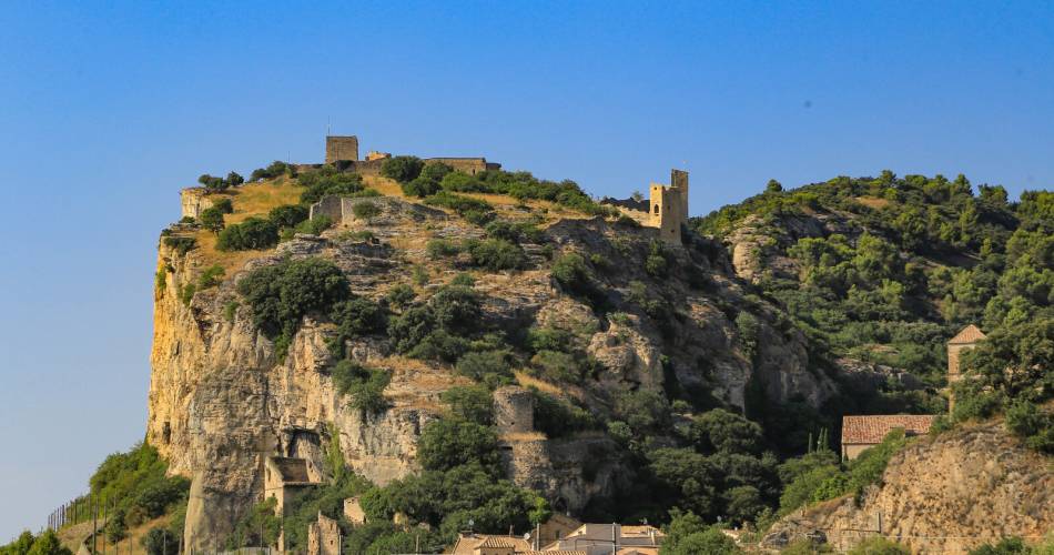
From Mornas, discover this massif between the Rhone valley and the wine-growing plain, where there are numerous trails and paths. The atmosphere is one of garrigue, pine forests and a few little nuggets from the past: castellas d'Uchaux, the medieval fortress of Mornas.
Accéder à l'itinéraire
public transport
By train TER lines - serving Orange (fr | ↗) or Bollène (fr | ↗).
Then via the Zou bus network, line 901, Les Bourgades stop (↗)
recommended
parking(s)
Place de la Paix - Mondragon
road access
From the A7 Exit Bollène, towards Mornas.
To be noted
- GPX track essential. Route not marked.
- Best in autumn, winter and spring. In summer, check the website to ensure the mountain is open and take fire risk into account.
 If you notice a problem on one of the Provence cycling routes report it with the Suricate app!: sentinelles.sportsdenature.fr
Access to the massifs
Respect the regulations preserving protected natural areas – find out about restrictions to accessing the massifs during fire risk periods, from 15 June to 15 September.
Before heading out, check the website
Respect the regulations preserving protected natural areas – find out about restrictions to accessing the massifs during fire risk periods, from 15 June to 15 September.
Before heading out, check the website
In short
Contact
Conseil départemental de Vaucluse - Maison des SportsE-Mail : cdpal@vaucluse.fr
Website : http://www.provenceguide.com