
Gravel 37: the Pavillon Rolland

Route
Loop
Difficulty
Difficult
Duration
4h
Distance
32.61km
Positive elevation
900 meters
Negative elevation
897 meters
Altitude
Min. 786 meters
Max. 1526 meters
- circuit
- variante
- voie verte
- liaison
Departure / Arrival
Pavillon de Rolland - Bédoin / Pavillon Roland
Parking
Pavillon Roland
Elevation
GPX track
The tourist service at Avignon :
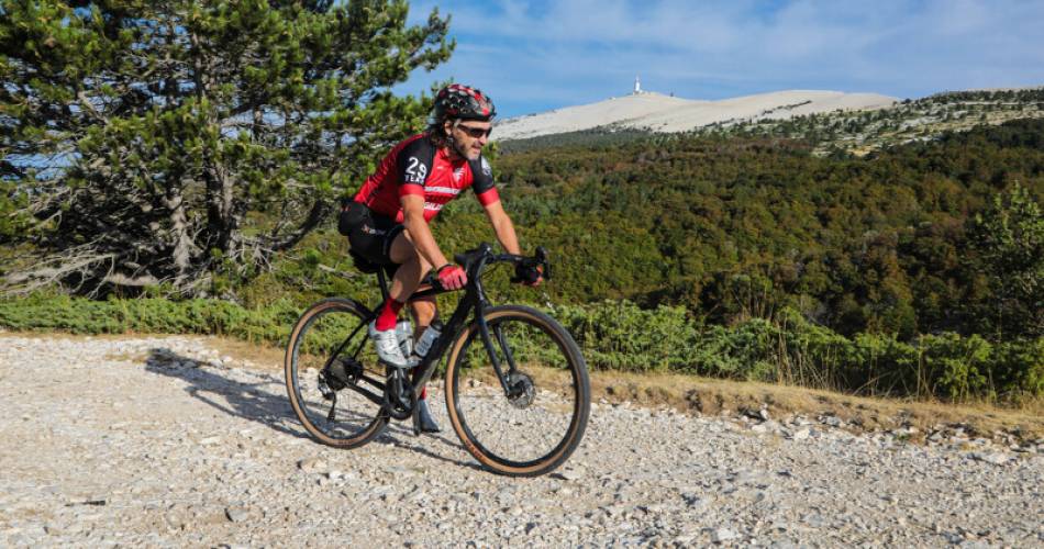
From Pavillon de Rolland, climb up a track to join the Piste des 1500, then turn right towards Chalet Reynard, passing at the foot of Jas des Pélerins. Return via the Plaine des Ermitans, then the Forêt de Perrache.Accéder à l'itinéraire
public transport
There is no public transport to the starting point. Consider carpooling!
recommended
parking(s)
Pavillon de Rolland - Bédoin
road access
From Avignon, take the D942 towards Bédoin, then the D974 towards Chalet Reynard. Le Pavillon de Rolland is located on the left as you drive uphill, approximately 5 km after the hamlet of Sainte Colombe.
To be noted
Recommended period: autumn for the colours.
 If you notice a problem on one of the Provence cycling routes report it with the Suricate app!: sentinelles.sportsdenature.fr
Access to the massifs
Respect the regulations preserving protected natural areas – find out about restrictions to accessing the massifs during fire risk periods, from 15 June to 15 September.
Before heading out, check the website
Respect the regulations preserving protected natural areas – find out about restrictions to accessing the massifs during fire risk periods, from 15 June to 15 September.
Before heading out, check the website
In short
A demanding route that is 100% uphill with panoramic views, between forests and spectacular scenery!Contact
Conseil départemental de Vaucluse - Maison des SportsE-Mail : info@provenceguide.com
Website : http://www.provenceguide.com